|
 |
 |
|
|
The Worldwide Voluntary Observing Ship Scheme The United States VOS Project Mission TurboWin Software Port Meteorological Officers VOS Conference iVOS VOS Ship Resource Page Mariners Weather Log Observing Handbook No. 1 VOS Awards Weather and Marine Related Links VOSClim |
Instructions for sending weather observations using Standard C and Code 41 (no charge to ship): JRC (Japan Radio Company) SoftwareTrimble SoftwareThrane and Thrane SoftwareFuruno SoftwareObservations Via EmailFrequently Asked QuestionsClick a question to view the answer.
Learn More About: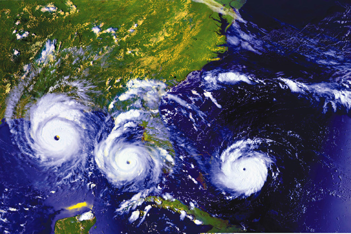 Tropical Cyclones Tropical Cyclones
Features a PPS slideshow that discusses a variety of information about tropical cyclones, including their structure, formation, phases of development (TD, TS, HURR etc), seasons, computer forecasting aids/models, and underway avoidance practices. 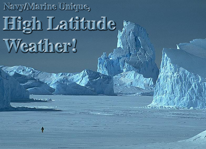 High Latitude Ship Operations High Latitude Ship Operations
A PPS slideshow related to the unique circumstances of operating in Polar Regions. Discusses such topics as Ice cover/Ice zones, Sea Ice formation and growth, types of sea ice (pictorial), Icebergs, including types, distribution, and dangers. Also discusses other phenomena including flaws and leads, ice blink, wind effects, fog, precipitation etc. In depth discussion about ice accretion causes, dangers and ways to avoid or mitigate the effects  Shipboard observations Shipboard observations
Get an introduction to the VOS program and weather basics. Learn why ship observations remain an important source of oceanic weather data, and about other oceanic weather data sources, their strengths and weaknesses. Contains a thorough lesson in observation encoding, including tons of tips and tricks to make observing easier. 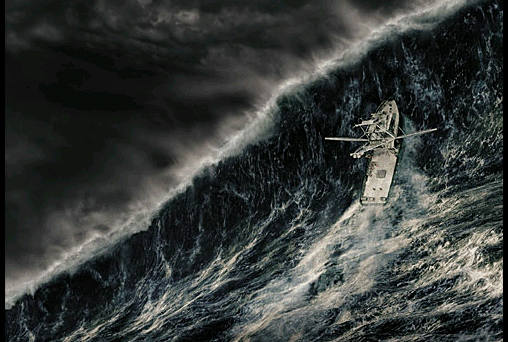 The North Wall The North Wall
Understand the mystery of large, steep waves often encountered in the Gulf Stream in winter. The principles discussed can be applied to the Agulhus and Kuroshio currents as well. 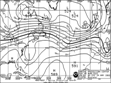 Marine Weather Charts Marine Weather Charts
Learn the basics of weather chart interpretation. Understand the significance and importance of the 500 MB, Surface, and Sea Height analysis and forecast charts (with plenty of example products). Also features examples of satellite imagery, ice charts, regional products and surface chart symbols. Tools and Links for the Mariner:Marine Weather Information Guide PDF Marine Radiofax Chart FTP Email Procedures PDF FTPmail for fax charts: Get NOAA fax charts through the e-mail. Send an e-mail request and receive the charts as a reply to your request (no additional cost).
Tropical Prediction Center (TPC) automated e-mail updates: Sign up with one e-mail and automatically receive the latest warnings and advisories via e-mail (no cost). Dial-a-buoy: Use a cell phone or sat phone to get information from any of hundreds of weather buoys. See what conditions look like ahead of you, before you get there. Fax schedules: NOAA fax schedules
PORTS webpage: a program of the National Ocean Service that supports safe and cost-efficient navigation by providing ship masters and pilots with accurate real-time information required to avoid groundings and collisions. CHANGES TO NATIONAL WEATHER SERVICE BROADCAST SCHEDULES: Broadcasts of National Weather Service marine forecasts from the following U.S. Coast Guard and military facilities will be modified on June 15, 2005 at 1400 UTC (1733 UTC for KVM70) to accommodate a greater range of products and reduce mutual interference between stations: International Ice Patrol Charts U.S. Coast Guard Storm Center: http://www.uscg.mil/news/stormcenter/ AMVER Program Homepage
|